
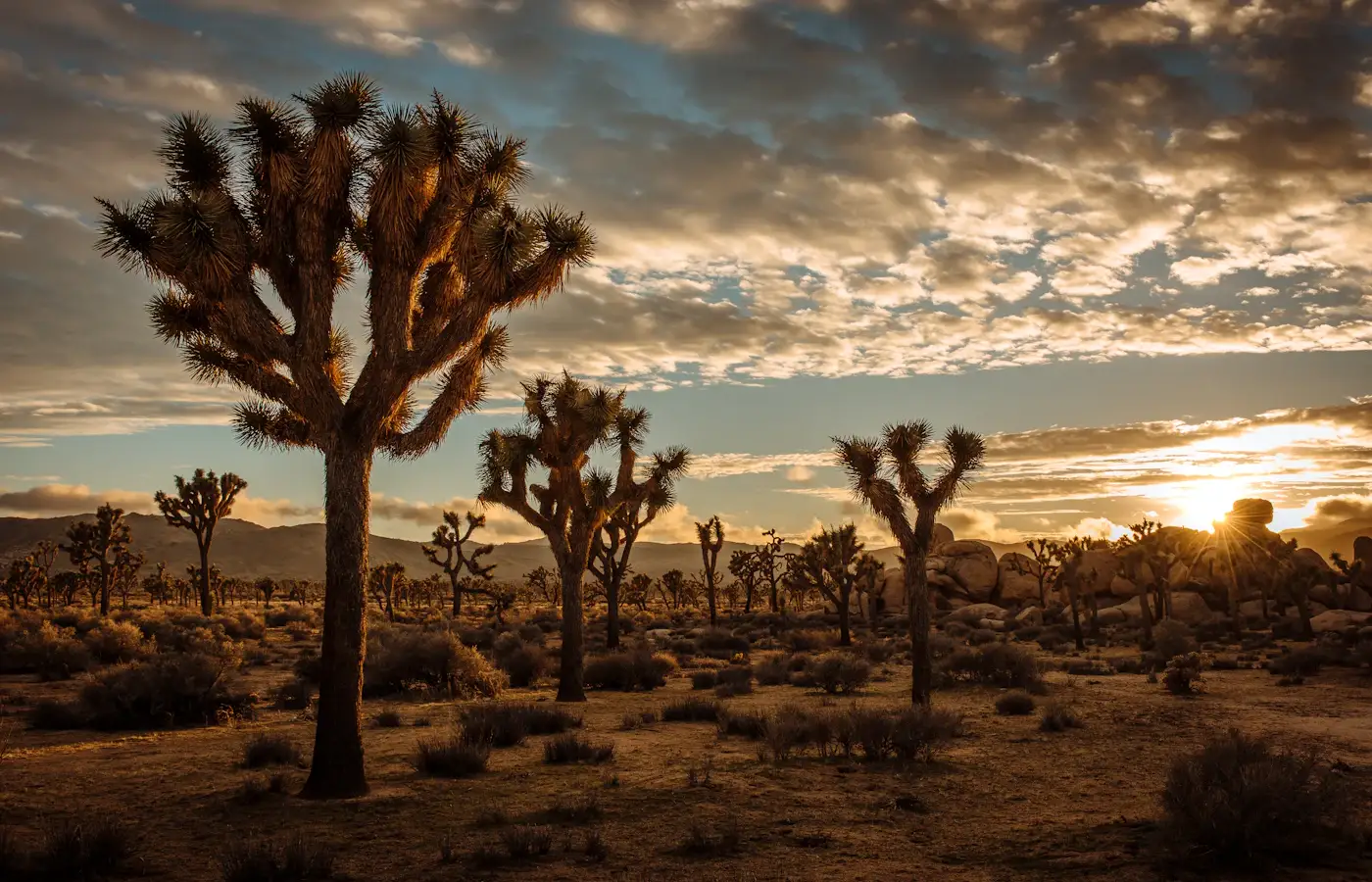
There’s a moment that happens to almost everyone on their first night camping in Joshua Tree, and it happened to me too: you step out of your tent or your van around 2am because you heard something, and you look up, and the sky just stops you cold. No haze, no glow, just an absurd, almost aggressive number of stars, the Milky Way laid out like a spill of salt across the whole sky. Joshua Tree National Park sits at the collision point of two deserts, the Mojave and the Colorado, and that collision creates one of the strangest, most photogenic landscapes in the entire American West — twisted yucca trees, house-sized boulder piles that look like they were stacked by giants, and a silence so complete you can hear your own pulse. If Big Sur is drama and the redwoods are scale, Joshua Tree is stillness, and it’s the desert detour every West Coast road trip deserves at least once.
This guide covers a complete Joshua Tree itinerary: which airport to fly into, why you need a car (and what kind), the exact route through the park, and a clear sequence of the best hikes, viewpoints, and towns to visit, in the order that makes the most sense given the park’s layout.
Where to Fly Into for a Joshua Tree Trip
Palm Springs International Airport (PSP)
This is the airport I recommend to almost everyone. Palm Springs International Airport is about 45 minutes to an hour from the park’s West Entrance near the town of Joshua Tree, and it has a surprising number of direct flights for a smaller airport, including nonstop routes from major hubs like Los Angeles, San Francisco, Seattle, Denver, Dallas, and even some seasonal routes from the East Coast. Flying into PSP also means you land right in Palm Springs itself, a great place to grab your rental car, stock up on supplies, and maybe enjoy a day of mid-century modern architecture and hot springs pools before you head into the desert.
Los Angeles International Airport (LAX)
LAX is the budget-friendly option, with far more flight availability and generally cheaper fares, but it comes with a real trade-off: the drive out to Joshua Tree is roughly two and a half to three hours depending on traffic, and LA traffic on I-10 East can be brutal, especially on Friday afternoons when half the city is doing the exact same desert getaway you are. If you fly into LAX, I’d actually recommend leaving very early in the morning or waiting until after evening rush hour to make the drive out.
Ontario International Airport (ONT)
A middle-ground option that a lot of people overlook: Ontario International Airport is smaller and less congested than LAX, generally has less brutal traffic to fight through, and cuts your drive time to Joshua Tree down to around an hour and a half to two hours. It’s worth checking fares here before defaulting to LAX.
Renting a Car — Why the Desert Demands It
Joshua Tree National Park has zero public transportation inside it, no shuttle system between the major sites (unlike some national parks such as Zion), and the distances between trailheads, viewpoints, and the surrounding towns are too far to walk or bike comfortably, especially given the heat for most of the year. There is also essentially no cell service inside large portions of the park, which makes ride-shares and taxis a non-starter. A rental car is completely non-negotiable here.
Book through Enterprise, Hertz, or a comparison engine like Kayak — all have counters at PSP, LAX, and ONT.
Do you need an SUV or 4WD?
For the main paved roads covered in this itinerary (Park Boulevard and Pinto Basin Road), a standard sedan is completely fine. Where you’ll want an SUV or, ideally, a genuine 4WD vehicle with good clearance is if you want to drive Geology Tour Road, Berdoo Canyon Road, or Pinkham Canyon Road, all rugged backcountry routes that access some of the park’s most remote and rewarding scenery but that regularly strand two-wheel-drive rental cars in soft sand. If backcountry routes aren’t part of your plan, don’t bother upgrading — you’ll see almost everything in this guide from a normal car.
Van life and RV rentals
Joshua Tree is one of the single best places in the country to do a van life desert trip, and honestly one of my personal favorite places to camp anywhere on Earth. The park has nine developed campgrounds, several of which — Jumbo Rocks, Hidden Valley, Ryan, and Belle among them — are absolutely gorgeous, tucked right into the boulder formations. Reserve well ahead through Recreation.gov, since sites (especially the reservable ones like Jumbo Rocks and Black Rock) sell out fast in the peak fall-through-spring season. For a van rental, Outdoorsy and Escape Campervans both have Los Angeles pickup locations, and RVshare is a solid peer-to-peer alternative. One important desert-specific note: bring more water than you think you need, and check your vehicle’s cooling system before a summer trip, since daytime temperatures regularly exceed 100°F from June through September.
The Route: Navigating Joshua Tree National Park
The park has three entrances — West Entrance near the town of Joshua Tree, North Entrance near Twentynine Palms, and South Entrance off Interstate 10 near Cottonwood Spring — and the main road through the park is Park Boulevard, which connects the West and North Entrances, with Pinto Basin Road branching southeast to connect to the South Entrance. The itinerary below enters via the West Entrance and exits via the South Entrance, which is the most logical sequence for seeing the park’s highlights in order without backtracking.
Day 1: The Town of Joshua Tree and the West Entrance Highlights
Stop 1: The Town of Joshua Tree
Base yourself in the small town of Joshua Tree, just outside the West Entrance, which has the best concentration of good food, coffee, and gear shops near the park. Stop at Park Boulevard area cafes, or grab breakfast at Pie for the People, a beloved local pizza and slice spot, before heading into the park. Stock up on water and snacks here — options inside the park itself are extremely limited.
Stop 2: West Entrance and Joshua Tree Visitor Center
Stop at the Joshua Tree Visitor Center to pick up a park map, check current trail and road conditions, and pay your entrance fee if you haven’t purchased one online in advance through Recreation.gov or the NPS fee page.
Stop 3: Hidden Valley
Your first stop inside the park should be Hidden Valley, a one-mile easy loop trail through a natural rock-enclosed valley that, according to local legend, was once used by cattle rustlers to hide stolen livestock. It’s an excellent, gentle introduction to the park’s signature boulder-pile geology and usually has rock climbers scaling the formations around you.
Stop 4: Barker Dam
A short drive further is Barker Dam, an easy 1.3-mile loop trail leading to a small reservoir built by early cattle ranchers, with a side spur to a rock art panel left by the Indigenous Serrano and Cahuilla peoples who have called this desert home for thousands of years. Wildlife sightings, including bighorn sheep, are common here, especially near water.
Stop 5: Keys View
Drive up to Keys View, a paved overlook road that climbs to over 5,000 feet and delivers one of the best panoramic views in the entire park — on a clear day you can see the Coachella Valley, the Salton Sea, and even into Mexico. This is one of the best sunset spots in the park, so if you’re timing your day around golden hour, save this for last.
Stop 6: Skull Rock
On your way back through, stop at Skull Rock, a roadside boulder formation that genuinely resembles a human skull, accessible via a short pullout trail right off Park Boulevard — a fun, quick stop, especially good for kids.
Camp at Hidden Valley or Jumbo Rocks Campground if you booked ahead through Recreation.gov, or stay in town at a hotel or Airbnb in Joshua Tree or Yucca Valley.
Day 2: Jumbo Rocks to the North Entrance
Stop 7: Jumbo Rocks
Start your morning hiking around Jumbo Rocks, home to some of the most dramatic and climbable boulder formations in the entire park, and a great spot for sunrise if you’re an early riser.
Stop 8: Skull Rock Nature Trail Loop
If you want a longer version of the Skull Rock stop from Day 1, the full 1.7-mile Skull Rock Nature Trail loop connects Jumbo Rocks Campground to Skull Rock itself and gives you a proper walk through classic Joshua Tree terrain.
Stop 9: Arch Rock (White Tank area)
Near White Tank Campground, a short half-mile trail leads to Arch Rock, a natural granite arch formed by erosion — one of the best short, easy hikes in the park and a great photo stop.
Stop 10: Twentynine Palms and the Oasis of Mara
Exit toward the North Entrance and stop in the town of Twentynine Palms, home to the Oasis Visitor Center and the Oasis of Mara, a fan palm oasis that was the original water source for the Serrano people who settled here. It’s a good, easy walk and a totally different ecosystem than the boulder fields you’ve spent the day in.
Stop 11: 29 Palms Inn and dinner in town
For dinner, 29 Palms Inn, built around the historic oasis, has a genuinely great restaurant using produce from their own garden — a well-loved local institution and a nice way to close out your second day.
Day 3: Cholla Cactus Garden to the South Entrance
This final day takes you down Pinto Basin Road through the transition zone between the Mojave and Colorado deserts, ending at the South Entrance near Cottonwood Spring.
Stop 12: Cholla Cactus Garden
Roughly in the middle of Pinto Basin Road, the Cholla Cactus Garden is a dense, otherworldly field of teddy-bear cholla cacti (deceptively fuzzy-looking, genuinely very sharp — do not touch) with an easy quarter-mile loop trail through the middle of it. This is one of the most photographed spots in the entire park, especially at sunrise or sunset when the spines backlight in gold.
Stop 13: Ocotillo Patch
A short drive further south, the Ocotillo Patch is a roadside stop showing off the tall, whip-like ocotillo plants that bloom bright red after rain — another quick, easy photo stop that shows off the biodiversity of this transition-zone desert.
Stop 14: Cottonwood Spring Oasis
Near the South Entrance, Cottonwood Spring is another fan palm oasis, historically used by prospectors and the Cahuilla people, with an easy loop trail and often good bird-watching. This makes a fitting, quiet final stop before you exit the park onto I-10.
Bonus: Stargazing and the Night Sky
Joshua Tree is an International Dark Sky Park, and honestly, a night here without at least one hour spent just lying on your back looking up is a wasted trip. The best stargazing spots are away from the main roads and campground light spill — Cap Rock, Hidden Valley, and the area around Ryan Campground are all excellent. New moon periods (check a lunar calendar before booking your trip) give you the darkest, most star-saturated skies. Bring a red-light headlamp to preserve your night vision and a warm layer, because desert nights drop dramatically in temperature even after scorching days.
Where to Eat and What to Book
Beyond the spots mentioned above, don’t miss Crossroads Cafe in the town of Joshua Tree for a hearty pre-hike breakfast, and if you want a guided experience rather than DIY, companies like GetYourGuide and Viator offer stargazing tours, rock climbing lessons, and jeep tours of the backcountry roads that require 4WD.
Practical Tips Before You Go
Water and heat
Carry at least one gallon of water per person per day, more if hiking. Summer (June through September) sees daytime highs regularly above 100°F and is genuinely dangerous for hiking midday — if you visit in summer, do your hiking at sunrise and treat midday as rest time.
Best season to visit
Fall through spring, roughly October through May, is the sweet spot, with daytime temperatures in the comfortable 60s and 70s Fahrenheit and cold, clear nights perfect for stargazing. Spring (March–April) can also bring wildflower blooms depending on winter rainfall.
Cell service and navigation
Cell coverage inside the park is minimal to nonexistent. Download offline maps before you enter, and pick up a paper park map at the visitor center as a backup — it’s a genuinely useful habit in a park this easy to get turned around in once the light starts to fade.
Entrance passes
A single vehicle pass is good for seven days and can be purchased in advance through Recreation.gov or at any entrance station. If you’re planning to visit multiple national parks on your West Coast trip (pair this easily with Yosemite or Death Valley), the America the Beautiful annual pass pays for itself after about three park visits.
More Trails Worth Your Time
The stops above cover the essential path through the park, but if you have an extra day or want to swap something out, a few more trails have earned permanent spots on my personal Joshua Tree rotation.
49 Palms Oasis
Near the North Entrance, this moderate 3-mile round trip hike climbs over a rocky ridge before dropping into a hidden canyon holding one of the park’s most impressive fan palm oases. It’s a bit more strenuous than most of the stops in this guide, with real elevation gain and very little shade, so bring extra water and avoid it during the heat of a summer afternoon.
Lost Horse Mine
A 4-mile round trip trail leading to one of the best-preserved historic gold mine sites in the park, dating back to the 1890s. It’s a great pick if you’re interested in the mining history that shaped a lot of this region before it became a protected park in 1936 (originally a national monument, later upgraded to national park status in 1994).
Ryan Mountain
If you want the single best 360-degree view in the entire park and don’t mind earning it, the Ryan Mountain Trail is a steep but short 3-mile round trip climb to the summit, with views stretching across the whole valley on a clear day. This is a fantastic sunrise hike if you’re an early riser, since you’ll likely have the summit entirely to yourself.
Split Rock Loop
A lesser-known 2-mile loop near the Belle and White Tank campgrounds, winding through classic boulder terrain with far fewer people than the more famous Hidden Valley trail. A good pick if you’re staying at one of those campgrounds and want an easy morning walk before breaking camp.
What to Pack for a Joshua Tree Desert Trip
Desert packing is its own particular science, and getting it wrong here can range from mildly uncomfortable to genuinely dangerous, especially in summer. Here’s what I never leave without.
- At least one gallon of water per person per day, more if you’re hiking or visiting in warmer months.
- Sun protection: a wide-brimmed hat, high-SPF sunscreen, and sunglasses — there is very little natural shade anywhere in the park.
- Layers for dramatic temperature swings. Desert days can be hot while nights drop into the 40s Fahrenheit or lower, even in spring and fall.
- Sturdy closed-toe shoes. The terrain is rocky and cactus spines are a real hazard if you’re wearing sandals off-trail.
- A physical park map, since cell service is minimal to nonexistent inside the park boundaries.
- A basic first aid kit, including tweezers specifically for cactus spine removal — teddy-bear cholla segments detach and embed shockingly easily.
- A headlamp with a red-light setting if you’re camping or stargazing, to preserve night vision for yourself and your camp neighbors.
- Extra fuel and a full tank of gas, since gas stations inside the park itself do not exist — fill up in Joshua Tree, Yucca Valley, or Twentynine Palms before entering.
A Little Desert Ecology, Because It Makes the Trip Richer
The Joshua tree itself (Yucca brevifolia) is not actually a tree in the botanical sense — it’s a member of the yucca family, more closely related to agaves and other desert succulents than to any pine or oak. Mormon settlers crossing the Mojave in the 19th century are said to have named it for its resemblance to the biblical figure Joshua raising his arms in prayer, though the story is likely more folklore than documented fact. These plants grow astonishingly slowly, sometimes less than half an inch a year, meaning some of the larger specimens you’ll walk past on the Hidden Valley or Skull Rock trails could be well over 300 years old.
The park sits at the ecological meeting point of two distinct deserts. The higher, cooler Mojave Desert to the west and north is where you’ll find the Joshua trees themselves, while the lower, hotter Colorado Desert to the east and south is dominated by ocotillo, cholla, and creosote bush — which is exactly why the drive down Pinto Basin Road on Day 3 of this itinerary feels like crossing into an entirely different landscape in the space of about 20 miles. Climate change poses a genuine, well-documented threat to Joshua trees specifically, with research suggesting the species may lose the majority of its current range within the park by the end of the century as temperatures rise — one more reason to go see them now rather than assuming they’ll always be exactly where they are today.
Frequently Asked Questions About Visiting Joshua Tree
How many days do you need in Joshua Tree National Park?
Three days, as laid out in this itinerary, gives you a well-paced trip covering the highlights without rushing. If you only have one day, focus on Hidden Valley, Keys View, and Cholla Cactus Garden — that trio captures the park’s essential character in a compact loop reachable from the West Entrance.
Is Joshua Tree safe to visit in summer?
It can be visited safely in summer with real precautions — plenty of water, hiking only at sunrise or sunset, and avoiding any strenuous trail during peak midday heat. That said, most experienced desert travelers, myself included, generally recommend visiting between October and May, when daytime temperatures are far more comfortable and the hiking is genuinely enjoyable rather than something to be endured.
Can you camp anywhere in the park, or only in designated campgrounds?
Joshua Tree allows dispersed backcountry camping in designated backcountry zones, but you must register at one of the backcountry boards near trailheads and follow strict rules about distance from roads and water sources. For most visitors, sticking to the nine developed campgrounds booked through Recreation.gov is simpler and still delivers an incredible night sky.
Are there restaurants or gas stations inside the park?
No — there is no fuel, and no restaurants inside the park boundaries. All services are in the surrounding towns of Joshua Tree, Yucca Valley, and Twentynine Palms, so plan your fuel and food stops accordingly before you enter for the day.
Can I bring my dog?
Dogs are allowed in campgrounds and in cars along paved roads, but are not permitted on any of the park’s hiking trails or in the backcountry, largely to protect the fragile desert ecosystem and local wildlife. If you’re traveling with a dog, plan on scenic drives and roadside stops rather than trail hikes.
Combining This Trip With the Rest of the West Coast
Joshua Tree pairs naturally with a broader Southern California itinerary. It’s an easy add-on to a Palm Springs getaway, sits within striking distance of Death Valley National Park to the north for those chasing a bigger desert-parks trip, and connects easily back to Los Angeles or San Diego if you want to close your West Coast loop with some time on the actual Pacific coastline after all that desert silence. I’ve done all three combinations at various points in my travels, and Joshua Tree has never once felt like the “detour” — if anything, it’s usually the part of the trip I end up telling people about first.
A Sample Two-Day Version, If Three Days Isn’t Possible
If you’re squeezed for time, here’s how I’d compress this itinerary into two days without losing the essential character of the park.
- Day 1: Enter via the West Entrance and hit Hidden Valley, Barker Dam, and Keys View in the morning and midday, then camp or stay in town near the West Entrance and spend the evening stargazing at Cap Rock or Hidden Valley.
- Day 2: Drive the full length of the park from Park Boulevard onto Pinto Basin Road, stopping at Skull Rock, Cholla Cactus Garden, and Ocotillo Patch, before exiting at the South Entrance near Cottonwood Spring and continuing on to your next destination.
You’ll miss Twentynine Palms and the northern oases this way, but you’ll still get a genuinely complete taste of both the Mojave and Colorado desert halves of the park.
A Bit of History That Makes the Trip Mean More
This land has been inhabited for thousands of years by Indigenous peoples, primarily the Serrano, Cahuilla, Chemehuevi, and Mojave, who developed sophisticated knowledge of the desert’s scattered water sources — the oases you’ll visit at Cottonwood Spring, Oasis of Mara, and 49 Palms are not incidental features but were essential, carefully known survival points along seasonal travel routes long before any road existed here. The rock art panel near Barker Dam on Day 1 of this itinerary is a direct, physical link to that much longer human history, and it’s worth pausing there a little longer than you might for the dam itself.
European-American settlement brought cattle ranching, mining, and eventually homesteading to the area in the late 19th and early 20th centuries — Lost Horse Mine and Barker Dam are both relics of that era. Concerned that unregulated development and cactus poaching (yes, that was a real problem — desert plants were being dug up and sold by the truckload) would destroy the landscape, a Pasadena socialite named Minerva Hoyt led a determined campaign through the 1920s and 1930s that ultimately convinced President Franklin D. Roosevelt to designate the area a national monument in 1936. It remained a national monument for nearly sixty years before Congress upgraded it to full national park status as part of the California Desert Protection Act of 1994, the same legislation that created Death Valley and Mojave National Preserve nearby. Hoyt’s advocacy is honored today with a peak named after her within the park, and I think about her every time I watch a sunset here, since without her, an awful lot of this landscape might well be a subdivision by now.
Rock Climbing in Joshua Tree
I’d be doing this guide a disservice if I didn’t mention that Joshua Tree is one of the most famous rock climbing destinations on Earth, with over 8,000 documented climbing routes across thousands of individual rock formations. Even if you’re not a climber yourself, you’ll see the sport everywhere throughout this itinerary, particularly around Hidden Valley and Jumbo Rocks, and it’s genuinely fun to sit and watch for a while. If you want to try it yourself, several local outfitters offer beginner-friendly guided climbs and lessons — Joshua Tree Rock Climbing School is one of the longest-established operators in the area, and booking a half-day lesson is a great way to experience the park’s geology in a completely different way than hiking alone provides.
Photography and Sunset Timing Tips
Joshua Tree is one of the most photogenic parks in the entire national park system, and a few small timing decisions make an enormous difference in your photos. The golden, low-angle light in the hour before sunset turns the granite boulders a deep orange-gold that simply doesn’t happen at any other time of day, so plan your Keys View or Cholla Cactus Garden visit around that window if photography matters to you. Midday light, by contrast, is harsh and flat here, washing out the subtle textures in the rock formations and creating unflattering shadows under the Joshua trees themselves — if you find yourself in the park at noon, treat it as a good time for a longer scenic drive rather than your primary photo stops. For night photography of the Milky Way, a tripod is essential, and the new moon window each month gives you the darkest possible skies for star photography.
Budgeting for a Joshua Tree Trip
Joshua Tree can be done extremely cheaply or as a proper indulgent desert escape, depending on how you structure your lodging. Camping in one of the nine park campgrounds runs in the $15–$25 per night range, an incredible value for waking up inside the boulder formations themselves. The town of Joshua Tree and nearby Yucca Valley have a growing number of stylish, mid-century-inspired Airbnbs and small motels that sit in a comfortable middle price range, while Palm Springs, about 45 minutes away, offers everything from budget motels to genuinely luxurious resort stays if you want to bookend your desert trip with a bit of pampering. Food is generally affordable in this region compared to more touristy parts of California — the local diners and taco spots in Joshua Tree and Twentynine Palms are both delicious and easy on the wallet.
Frequently Asked Questions, Continued
Is there an entrance fee for Joshua Tree National Park?
Yes, a standard per-vehicle fee applies (check current pricing on the official NPS fee page, since rates are periodically adjusted), valid for seven consecutive days. If you’re visiting multiple national parks during your West Coast trip, the America the Beautiful annual pass is almost always the better value.
How crowded does Joshua Tree get?
Weekends from October through May, especially around holidays, can see genuinely significant crowds and full parking lots at the most popular stops like Hidden Valley and Keys View. Visiting on a weekday, or arriving at your first stop before 9am, makes a substantial difference. Summer, despite the heat, is actually the quietest season if you don’t mind the temperatures and plan your hiking around sunrise.
Can I do Joshua Tree as a day trip from Los Angeles or San Diego?
From Los Angeles, yes, though it’s a long day — figure on roughly five to six hours of round-trip driving alone, leaving a solid five or six hours to actually explore. From San Diego, it’s doable but pushes closer to a seven-hour round trip, which I’d only recommend if a day trip is genuinely your only option.
Is Joshua Tree good for families with young kids?
Very much so. Most of the standout stops in this itinerary — Skull Rock, Cholla Cactus Garden, Arch Rock, Barker Dam — are short, flat, and genuinely fun for kids to scramble around, and the novelty of the twisted Joshua trees themselves tends to captivate younger visitors more than a typical forest hike might.
What’s the difference between the West, North, and South Entrances?
The West Entrance, near the town of Joshua Tree, is the busiest and closest to the highest concentration of iconic stops like Hidden Valley and Keys View. The North Entrance, near Twentynine Palms, is a good alternative if you’re staying on that side of the park or want a quieter start to your day. The South Entrance, off Interstate 10 near Cottonwood Spring, is the least trafficked and works best as an exit point after driving the length of Pinto Basin Road, exactly as laid out on Day 3 of this itinerary.
Do I need to make campground reservations in advance?
For the park’s most popular reservable campgrounds — Jumbo Rocks, Black Rock, Indian Cove, and Cottonwood — yes, absolutely, especially for weekends between October and May, when they can book out weeks ahead through Recreation.gov. A handful of smaller campgrounds remain first-come, first-served, but I wouldn’t rely on finding an open site without a reservation during peak season.
What’s the best way to avoid the crowds at the most famous spots?
Arrive at Hidden Valley and Keys View right at sunrise, when the light is arguably the best of the whole day anyway and the parking lots that will be overflowing by 10am are still nearly empty. If you’re a night owl instead of a morning person, the reverse strategy also works — many day visitors leave by late afternoon, so the couple of hours before sunset often see a second lull in crowds at the same popular stops, right before the golden light photography window I mentioned earlier kicks in.
How does Joshua Tree compare to Death Valley for a first desert trip?
They’re both extraordinary, but they scratch different itches. Joshua Tree is more compact, easier to explore on foot with a wide range of short, rewarding trails, and generally more forgiving for a first-time desert traveler. Death Valley is far larger, more extreme in its temperatures and distances, and rewards a slightly more experienced road-tripper who’s comfortable with long stretches between services. If this is your first desert national park, I’d start here — Joshua Tree is the friendlier introduction, and once you’re hooked, Death Valley will be waiting.
Is Joshua Tree a good pairing with a Palm Springs trip?
Absolutely, and it’s one of my favorite combinations in Southern California. Spend a day or two in Palm Springs soaking up mid-century architecture, hot springs, and a genuinely great restaurant scene, then head up into the desert stillness of Joshua Tree for a complete change of pace, only 45 minutes away. The contrast between resort-town Palm Springs and the raw, quiet expanse of the national park makes for a surprisingly well-rounded short trip if you’re tight on time but want a real taste of the Southern California desert.
Joshua Tree has a way of resetting something in you that I haven’t quite found words for after all these years of chasing it. Maybe it’s the silence, maybe it’s the strangeness of the trees themselves, twisted into shapes that look almost deliberate. Whatever it is, give yourself the full three days, get off the pavement onto at least a few of these short trails, and stay up late enough to actually see the stars. That’s the whole trip, really.
Photo by Cedric Letsch on Unsplash.